
Loiret topographic map
Interactive map
Click on the map to display elevation.
About this map
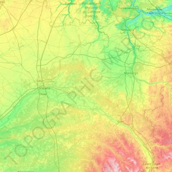
Name: Loiret topographic map, elevation, terrain.
Location: Loiret, Centre-Val de Loire, Metropolitan France, France (47.48306 1.51220 48.34495 3.12864)
Average elevation: 135 m
Minimum elevation: 43 m
Maximum elevation: 361 m