
Thank you for supporting this site ❤️
Make a donation
Make a donation
Cher topographic map
Click on the map to display elevation.
Thank you for supporting this site ❤️
Make a donation
Make a donation
About this map
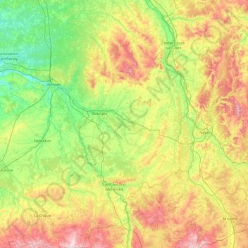
Name: Cher topographic map, elevation, terrain.
Location: Cher, Centre-Val de Loire, Metropolitan France, France (46.42046 1.77390 47.62910 3.07921)
Average elevation: 207 m
Minimum elevation: 81 m
Maximum elevation: 495 m
Thank you for supporting this site ❤️
Make a donation
Make a donation