
Bas-Rhin topographic map
Interactive map
Click on the map to display elevation.
About this map
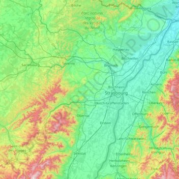
Name: Bas-Rhin topographic map, elevation, terrain.
Location: Bas-Rhin, Grand Est, Metropolitan France, France (48.12043 6.94063 49.07779 8.23285)
Average elevation: 315 m
Minimum elevation: 104 m
Maximum elevation: 1,274 m