
Irving topographic map
Click on the map to display elevation.
About this map
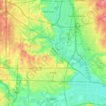
Name: Irving topographic map, elevation, terrain.
Location: Irving, Dallas County, Texas, United States (32.77179 -97.03404 32.95397 -96.88878)
Average elevation: 149 m
Minimum elevation: 120 m
Maximum elevation: 196 m