
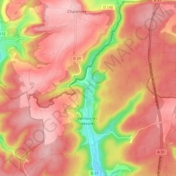
Vernois-lès-Vesvres topographic map
Interactive map
Click on the map to display elevation.
About this map
Name: Vernois-lès-Vesvres topographic map, elevation, terrain.
Average elevation: 429 m
Minimum elevation: 317 m
Maximum elevation: 479 m
Other topographic maps
Click on a map to view its topography, its elevation and its terrain.
Bierre en Morvan
France > Bourgogne – Franche-Comté > Côte-d'Or > La Roche-en-Brenil
Average elevation: 385 m