
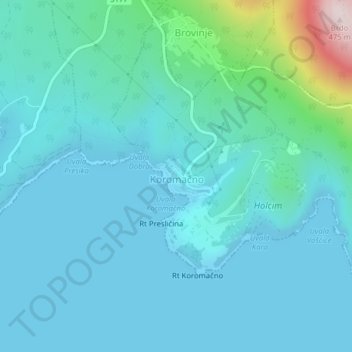
Koromačno topographic map
Interactive map
Click on the map to display elevation.
About this map
Name: Koromačno topographic map, elevation, terrain.
Location: Koromačno, Općina Raša, Istria County, Croatia (44.95673 14.11259 44.98235 14.15190)
Average elevation: 62 m
Minimum elevation: 0 m
Maximum elevation: 467 m
Other topographic maps
Click on a map to view its topography, its elevation and its terrain.
Višnjan
Višnjan is located 12 kilometers east of Poreč and 3 kilometers west of Pula-Koper road. Višnjan is located on elevation of 244m and average municipality elevation is between 200-300m. One of the most notable sinkholes in Istria, Baredina, is located in the municipality.
Average elevation: 221 m