
Khao Sok National Park topographic map
Interactive map
Click on the map to display elevation.
About this map
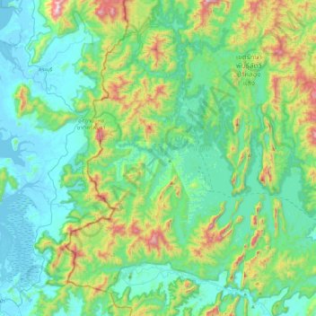
Name: Khao Sok National Park topographic map, elevation, terrain.
Location: Khao Sok National Park, Surat Thani Province, 84230, Thailand (8.84767 98.44314 9.28970 98.83209)
Average elevation: 232 m
Minimum elevation: -2 m
Maximum elevation: 1,062 m
Other topographic maps
Click on a map to view its topography, its elevation and its terrain.
Ko Tao
Thailand > Surat Thani Province > Ko Tao
Ko Tao, Surat Thani Province, Thailand
Average elevation: 35 m