
Thank you for supporting this site ❤️
Make a donation
Make a donation
Middle East topographic map
Click on the map to display elevation.
Thank you for supporting this site ❤️
Make a donation
Make a donation
About this map
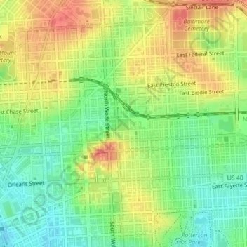
Name: Middle East topographic map, elevation, terrain.
Location: Middle East, Baltimore, Maryland, United States (39.29838 -76.59451 39.30465 -76.58513)
Average elevation: 29 m
Minimum elevation: 3 m
Maximum elevation: 55 m
Thank you for supporting this site ❤️
Make a donation
Make a donation