
Thank you for supporting this site ❤️
Make a donation
Make a donation
Campton Township topographic map
Click on the map to display elevation.
Thank you for supporting this site ❤️
Make a donation
Make a donation
About this map
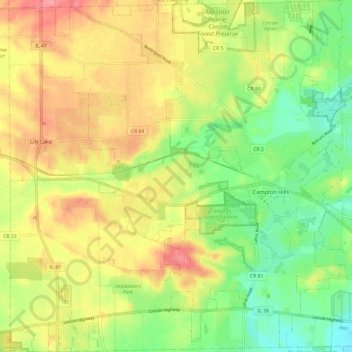
Name: Campton Township topographic map, elevation, terrain.
Location: Campton Township, Kane County, Illinois, United States (41.89562 -88.48880 41.98456 -88.37479)
Average elevation: 267 m
Minimum elevation: 224 m
Maximum elevation: 313 m
Thank you for supporting this site ❤️
Make a donation
Make a donation
Other topographic maps
Click on a map to view its topography, its elevation and its terrain.