
Thank you for supporting this site ❤️
Make a donation
Make a donation
Jura topographic map
Click on the map to display elevation.
Thank you for supporting this site ❤️
Make a donation
Make a donation
About this map
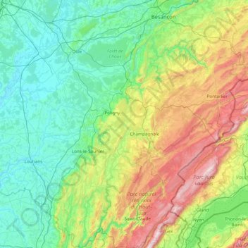
Name: Jura topographic map, elevation, terrain.
Location: Jura, Bourgogne-Franche-Comté, Metropolitan France, France (46.26102 5.25202 47.30576 6.20739)
Average elevation: 509 m
Minimum elevation: 174 m
Maximum elevation: 1,703 m
Thank you for supporting this site ❤️
Make a donation
Make a donation