
Pyrénées-Orientales topographic map
Interactive map
Click on the map to display elevation.
About this map
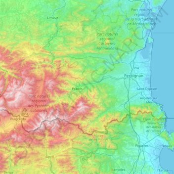
Name: Pyrénées-Orientales topographic map, elevation, terrain.
Location: Pyrénées-Orientales, Occitania, Metropolitan France, France (42.33276 1.72253 42.91865 3.17787)
Average elevation: 652 m
Minimum elevation: -4 m
Maximum elevation: 2,892 m