
Bukit Mengkibol topographic map
Interactive map
Click on the map to display elevation.
About this map
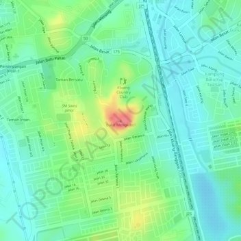
Name: Bukit Mengkibol topographic map, elevation, terrain.
Location: Bukit Mengkibol, Kluang, Johor, 86000, Malaysia (2.01385 103.31561 2.01395 103.31571)
Average elevation: 49 m
Minimum elevation: 25 m
Maximum elevation: 101 m