
Johor Bahru topographic map
Interactive map
Click on the map to display elevation.
About this map
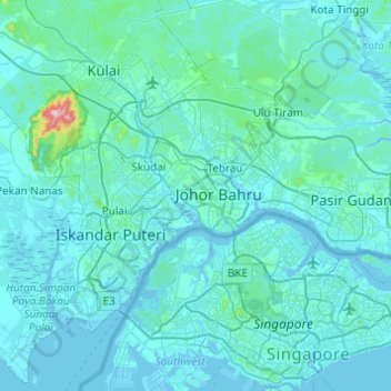
Name: Johor Bahru topographic map, elevation, terrain.
Location: Johor Bahru, Iskandar Malaysia, Johor, Malaysia (1.32936 103.53555 1.67186 104.02331)
Average elevation: 27 m
Minimum elevation: -6 m
Maximum elevation: 613 m
Other topographic maps
Click on a map to view its topography, its elevation and its terrain.