Geolocate

Rayong topographic map

Interactive map

Click on the map to display elevation.

About this map

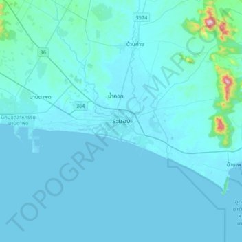
Name: Rayong topographic map, elevation, terrain.

Location: Rayong, Choeng Noen, Rayong Province, 21000, Thailand (12.52179 101.11777 12.84179 101.43777)

Average elevation: 31 m

Minimum elevation: -3 m

Maximum elevation: 687 m

Other topographic maps

Click on a map to view its topography, its elevation and its terrain.

Ao Hin Khok

Thailand > Rayong Province

Ao Hin Khok, Klaeng Kachet, Rayong Province, 21160, Thailand

Average elevation: 7 m

Map Ta Phut

Thailand > Rayong Province > Map Ta Phut

Map Ta Phut, Thap Ma, Rayong Province, 21150, Thailand

Average elevation: 24 m