
San Isidro de El General topographic map
Interactive map
Click on the map to display elevation.
San Isidro de El General
San Isidro de El General has an area of 191.53 km² and an elevation of 702 metres.
About this map
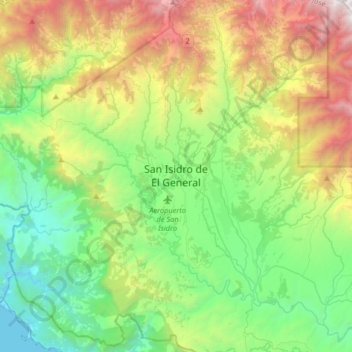
Name: San Isidro de El General topographic map, elevation, terrain.
Average elevation: 1,056 m
Minimum elevation: 0 m
Maximum elevation: 3,315 m