
Thank you for supporting this site ❤️
Make a donation
Make a donation
Padrón topographic map
Click on the map to display elevation.
Thank you for supporting this site ❤️
Make a donation
Make a donation
About this map
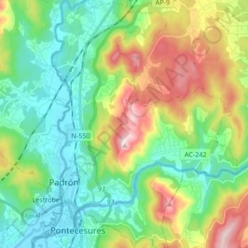
Name: Padrón topographic map, elevation, terrain.
Location: Padrón, O Sar, Galicia, Spain (42.71425 -8.68611 42.80745 -8.57058)
Average elevation: 139 m
Minimum elevation: -3 m
Maximum elevation: 435 m
Thank you for supporting this site ❤️
Make a donation
Make a donation
Other topographic maps
Click on a map to view its topography, its elevation and its terrain.