
Iceland topographic map
Interactive map
Click on the map to display elevation.
About this map
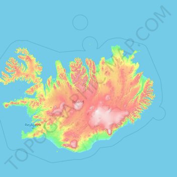
Name: Iceland topographic map, elevation, terrain.
Location: Iceland (63.08592 -25.01351 67.35300 -12.80462)
Average elevation: 158 m
Minimum elevation: -5 m
Maximum elevation: 2,000 m
The highest elevation for Iceland is listed as 2,110 m (6,923 ft) at Hvannadalshnúkur (64°00′N 16°39′W).
Other topographic maps
Click on a map to view its topography, its elevation and its terrain.