
Thank you for supporting this site ❤️
Make a donation
Make a donation
Chandigarh topographic map
Click on the map to display elevation.
Thank you for supporting this site ❤️
Make a donation
Make a donation
Chandigarh
Chandigarh is located by the foothills of the Shivalik Range of the Himalayas in northwest India. It covers an area of approximately 114 km2. It borders the states of Punjab and Haryana. The exact geographic coordinates of Chandigarh are 30°44′N 76°47′E / 30.74°N 76.79°E / 30.74; 76.79. It has an average elevation of 321 metres (1053 ft).
Thank you for supporting this site ❤️
Make a donation
Make a donation
About this map
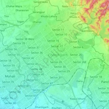
Name: Chandigarh topographic map, elevation, terrain.
Location: Chandigarh, India (30.66497 76.70499 30.79495 76.84903)
Average elevation: 343 m
Minimum elevation: 300 m
Maximum elevation: 511 m
Thank you for supporting this site ❤️
Make a donation
Make a donation