
Idaho topographic map
Interactive map
Click on the map to display elevation.
Idaho
Idaho's climate varies widely. Although the state's western border is about 350 miles (560 km) from the Pacific Ocean, the maritime influence is still felt in Idaho, especially in the winter when cloud cover, humidity, and precipitation are at their maximum extent. This influence has a moderating effect in the winter where temperatures are not as low as would otherwise be expected for a northern state with predominantly high elevations. The maritime influence is least prominent in the state's eastern part where the precipitation patterns are often reversed, with wetter summers and drier winters, and seasonal temperature differences are more extreme, showing a more semi-arid continental climate.
About this map
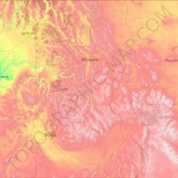
Name: Idaho topographic map, elevation, terrain.
Location: Idaho, United States of America (41.98808 -117.24303 49.00084 -111.04356)
Average elevation: 1,533 m
Minimum elevation: 102 m
Maximum elevation: 4,034 m