
Lake Saint Clair topographic map
Interactive map
Click on the map to display elevation.
About this map
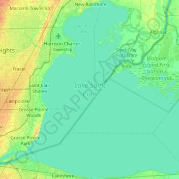
Name: Lake Saint Clair topographic map, elevation, terrain.
Location: Lake Saint Clair, Southwestern Ontario, Ontario, Canada (42.29658 -82.94216 42.69047 -82.40802)
Average elevation: 177 m
Minimum elevation: 171 m
Maximum elevation: 199 m
Other topographic maps
Click on a map to view its topography, its elevation and its terrain.