
Moselle topographic map
Interactive map
Click on the map to display elevation.
About this map
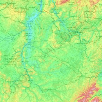
Name: Moselle topographic map, elevation, terrain.
Location: Moselle, Grand Est, Metropolitan France, France (48.52656 5.89185 49.51494 7.63882)
Average elevation: 289 m
Minimum elevation: 141 m
Maximum elevation: 1,017 m
Other topographic maps
Click on a map to view its topography, its elevation and its terrain.