
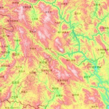
Lancang Lahu Autonomous County topographic map
Interactive map
Click on the map to display elevation.
About this map
Name: Lancang Lahu Autonomous County topographic map, elevation, terrain.
Average elevation: 1,387 m
Minimum elevation: 581 m
Maximum elevation: 2,533 m
Lancang County is located in southwestern Yunnan below the Tropic of Cancer, spanning latitude 22°01'−23°16' N and longitude 99°29'−100°35' E and an area of 8,807 km2 (3,400 sq mi), making it the second-largest county in the province in terms of area. It has an international border with Burma's Shan State totaling 80.563 km (50.060 mi) in length. It is heavily mountainous and situated among the Hengduan Mountains, with the elevation ranging from 2,516 m (8,255 ft) at Mount Malihei (麻栗黑山) in Xincheng Township (新城乡) to 578 m (1,896 ft) in Yakou Township (雅口乡).