
Lake Oswego topographic map
Interactive map
Click on the map to display elevation.
About this map
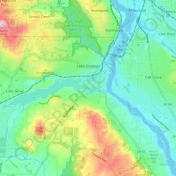
Name: Lake Oswego topographic map, elevation, terrain.
Location: Lake Oswego, Metro, Oregon, United States (45.38229 -122.74789 45.44035 -122.64252)
Average elevation: 87 m
Minimum elevation: -7 m
Maximum elevation: 288 m