
San Miguel County topographic map
Interactive map
Click on the map to display elevation.
About this map
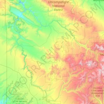
Name: San Miguel County topographic map, elevation, terrain.
Location: San Miguel County, Colorado, United States (37.77207 -109.04294 38.15310 -107.73111)
Average elevation: 2,357 m
Minimum elevation: 1,496 m
Maximum elevation: 4,238 m
Other topographic maps
Click on a map to view its topography, its elevation and its terrain.
Longmont
United States > Colorado > Boulder County > Longmont
Longmont, Boulder County, Colorado, United States
Average elevation: 1,534 m