
Wooroloo topographic map
Interactive map
Click on the map to display elevation.
About this map
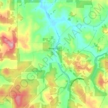
Name: Wooroloo topographic map, elevation, terrain.
Location: Wooroloo, Shire Of Mundaring, Western Australia, Australia (-31.84827 116.28168 -31.76879 116.37098)
Average elevation: 273 m
Minimum elevation: 208 m
Maximum elevation: 373 m