
Longmont topographic map
Interactive map
Click on the map to display elevation.
About this map
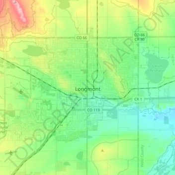
Name: Longmont topographic map, elevation, terrain.
Location: Longmont, Boulder County, Colorado, United States (40.12639 -105.17838 40.20996 -105.01732)
Average elevation: 1,534 m
Minimum elevation: 1,483 m
Maximum elevation: 1,649 m
The elevation at City Hall is 4,978 feet (1,517 m) above sea level. St. Vrain Creek, a tributary of the South Platte River, flows through the city just south of the city center.