
Thank you for supporting this site ❤️
Make a donation
Make a donation
Katari topographic map
Click on the map to display elevation.
Thank you for supporting this site ❤️
Make a donation
Make a donation
About this map
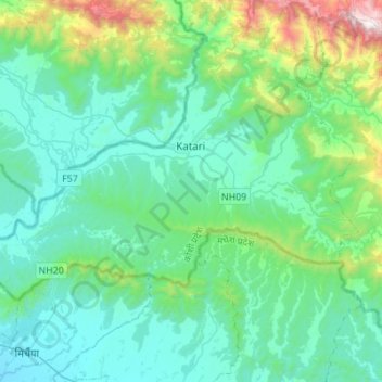
Name: Katari topographic map, elevation, terrain.
Location: Katari, Udayapur, Province #1, Nepal (26.86411 86.15551 27.00441 86.43021)
Average elevation: 401 m
Minimum elevation: 109 m
Maximum elevation: 1,767 m
Thank you for supporting this site ❤️
Make a donation
Make a donation