
Bajura topographic map
Interactive map
Click on the map to display elevation.
About this map
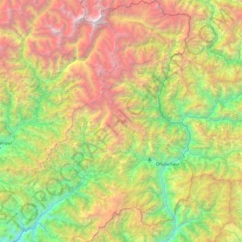
Name: Bajura topographic map, elevation, terrain.
Location: Bajura, Sudurpashchim Pradesh, Nepal (29.27157 81.16948 29.94956 81.80838)
Average elevation: 3,044 m
Minimum elevation: 819 m
Maximum elevation: 6,994 m