Geolocate

West Cork topographic map

Interactive map

Click on the map to display elevation.

About this map

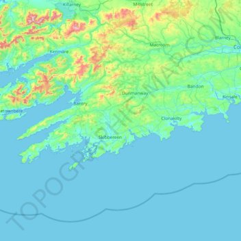
Name: West Cork topographic map, elevation, terrain.

Location: West Cork, County Cork, Munster, Ireland (51.38887 -10.30252 51.83673 -8.80738)

Average elevation: 83 m

Minimum elevation: 0 m

Maximum elevation: 971 m

Other topographic maps

Click on a map to view its topography, its elevation and its terrain.

Bray

Ireland > County Wicklow

Bray, County Wicklow, Leinster, Ireland

Average elevation: 42 m

Limerick

Ireland > County Limerick > Limerick

Limerick, County Limerick, Munster, Ireland

Average elevation: 45 m