
Horseshoe Mesa topographic map
Interactive map
Click on the map to display elevation.
About this map
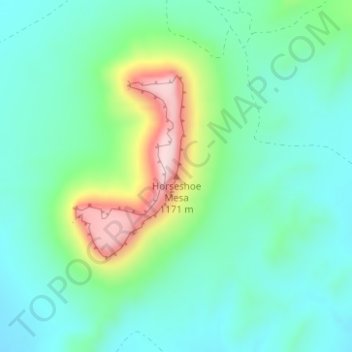
Name: Horseshoe Mesa topographic map, elevation, terrain.
Location: Horseshoe Mesa, Brewster County, Texas, United States (29.86847 -102.82160 29.86857 -102.82150)
Average elevation: 1,010 m
Minimum elevation: 929 m
Maximum elevation: 1,232 m
Other topographic maps
Click on a map to view its topography, its elevation and its terrain.
Alpine
United States > Texas > Brewster County
Alpine, Brewster County, Texas, United States
Average elevation: 1,373 m
Terlingua
United States > Texas > Brewster County
Terlingua, Brewster County, Texas, United States
Average elevation: 872 m
Alpine
United States > Texas > Brewster County
Alpine, Brewster County, Texas, United States
Average elevation: 1,373 m
Big Bend National Park
United States > Texas > Brewster County
Big Bend National Park, Brewster County, Texas, 79834, United States
Average elevation: 934 m
Big Bend National Park
United States > Texas > Brewster County
Big Bend National Park, Brewster County, Texas, 79834, United States
Average elevation: 934 m
Marathon
United States > Texas > Brewster County
Marathon, Brewster County, Texas, 79842, United States
Average elevation: 1,244 m
Cathedral Mountain
United States > Texas > Brewster County
Cathedral Mountain, Brewster County, Texas, United States
Average elevation: 1,627 m
Santiago Peak
United States > Texas > Brewster County
Santiago Peak, Brewster County, Texas, United States
Average elevation: 1,525 m
Dagger Mountain
United States > Texas > Brewster County
Dagger Mountain, Brewster County, Texas, United States
Average elevation: 1,068 m
Lajitas
United States > Texas > Brewster County
Lajitas, Brewster County, Texas, United States
Average elevation: 755 m
Emory Peak
United States > Texas > Brewster County
Emory Peak, Brewster County, Texas, United States
Average elevation: 2,061 m