
Thank you for supporting this site ❤️
Make a donation
Make a donation
Parker topographic map
Click on the map to display elevation.
Thank you for supporting this site ❤️
Make a donation
Make a donation
About this map
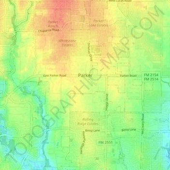
Name: Parker topographic map, elevation, terrain.
Location: Parker, Collin County, Texas, United States (33.01769 -96.65717 33.08555 -96.57713)
Average elevation: 180 m
Minimum elevation: 157 m
Maximum elevation: 203 m
Thank you for supporting this site ❤️
Make a donation
Make a donation