
Thank you for supporting this site ❤️
Make a donation
Make a donation
Plañel topographic map
Click on the map to display elevation.
Thank you for supporting this site ❤️
Make a donation
Make a donation
About this map
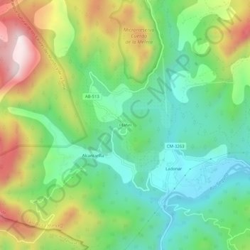
Name: Plañel topographic map, elevation, terrain.
Location: Plañel, Yeste, Albacete, Castilla-La Mancha, España (38.28448 -2.45232 38.32448 -2.41232)
Average elevation: 884 m
Minimum elevation: 645 m
Maximum elevation: 1,303 m
Thank you for supporting this site ❤️
Make a donation
Make a donation