
Thank you for supporting this site ❤️
Make a donation
Make a donation
Gemarang topographic map
Click on the map to display elevation.
Thank you for supporting this site ❤️
Make a donation
Make a donation
About this map
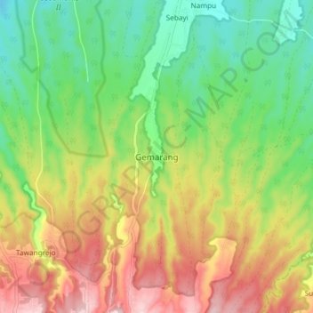
Name: Gemarang topographic map, elevation, terrain.
Location: Gemarang, Madiun, East Java, Java, Indonesia (-7.67001 111.69969 -7.59001 111.77969)
Average elevation: 229 m
Minimum elevation: 113 m
Maximum elevation: 386 m
Thank you for supporting this site ❤️
Make a donation
Make a donation
Other topographic maps
Click on a map to view its topography, its elevation and its terrain.