
Thank you for supporting this site ❤️
Make a donation
Make a donation
Kedungwuni topographic map
Click on the map to display elevation.
Thank you for supporting this site ❤️
Make a donation
Make a donation
About this map
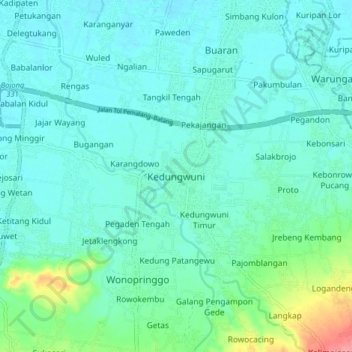
Name: Kedungwuni topographic map, elevation, terrain.
Location: Kedungwuni, Pekalongan, Central Java, Java, 51173, Indonesia (-7.00249 109.60375 -6.92249 109.68375)
Average elevation: 20 m
Minimum elevation: 5 m
Maximum elevation: 85 m
Thank you for supporting this site ❤️
Make a donation
Make a donation