
Thank you for supporting this site ❤️
Make a donation
Make a donation
Pritchard topographic map
Click on the map to display elevation.
Thank you for supporting this site ❤️
Make a donation
Make a donation
About this map
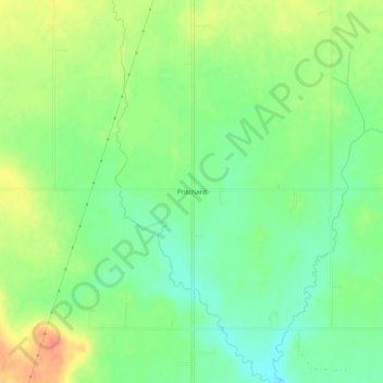
Name: Pritchard topographic map, elevation, terrain.
Location: Pritchard, Bryan County, Oklahoma, United States (34.06426 -96.16721 34.10426 -96.12721)
Average elevation: 196 m
Minimum elevation: 175 m
Maximum elevation: 222 m
Thank you for supporting this site ❤️
Make a donation
Make a donation