
Balad District topographic map
Interactive map
Click on the map to display elevation.
About this map
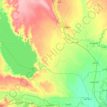
Name: Balad District topographic map, elevation, terrain.
Location: Balad District, Saladin Governorate, 07801600, Iraq (33.77133 43.13873 34.08470 44.46052)
Average elevation: 63 m
Minimum elevation: 30 m
Maximum elevation: 137 m
Other topographic maps
Click on a map to view its topography, its elevation and its terrain.