
Bigfork topographic map
Click on the map to display elevation.
About this map
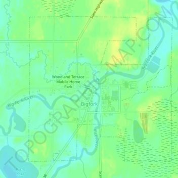
Name: Bigfork topographic map, elevation, terrain.
Location: Bigfork, Itasca County, Minnesota, United States (47.73577 -93.66775 47.75777 -93.63526)
Average elevation: 402 m
Minimum elevation: 393 m
Maximum elevation: 412 m
Other topographic maps
Click on a map to view its topography, its elevation and its terrain.