
Venezuela topographic map
Interactive map
Click on the map to display elevation.
About this map
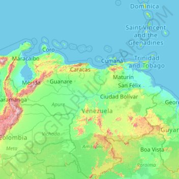
Name: Venezuela topographic map, elevation, terrain.
Location: Venezuela (0.64753 -73.35296 15.91584 -59.54271)
Average elevation: 218 m
Minimum elevation: -3 m
Maximum elevation: 5,229 m
Other topographic maps
Click on a map to view its topography, its elevation and its terrain.