
Thank you for supporting this site ❤️
Make a donation
Make a donation
Janesville topographic map
Click on the map to display elevation.
Thank you for supporting this site ❤️
Make a donation
Make a donation
Janesville
Janesville (also known as Lassen) is a sparsely populated census-designated place in Lassen County, California. It is located 11 miles (18 km) southeast of Susanville, at an elevation of 4239 feet (1292 m). Janesville is located on the eastern slopes of the Sierra Nevada Mountain range. Its population is 2,461 as of the 2020 census, up from 1,408 from the 2010 census.
Thank you for supporting this site ❤️
Make a donation
Make a donation
About this map
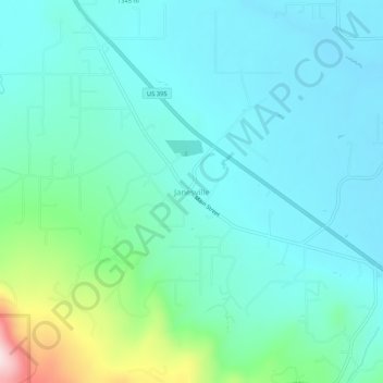
Name: Janesville topographic map, elevation, terrain.
Average elevation: 1,332 m
Minimum elevation: 1,254 m
Maximum elevation: 1,673 m
Thank you for supporting this site ❤️
Make a donation
Make a donation
Other topographic maps
Click on a map to view its topography, its elevation and its terrain.