
Thank you for supporting this site ❤️
Make a donation
Make a donation
Yalabowa topographic map
Click on the map to display elevation.
Thank you for supporting this site ❤️
Make a donation
Make a donation
About this map
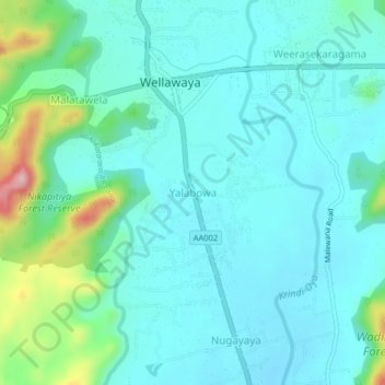
Name: Yalabowa topographic map, elevation, terrain.
Location: Yalabowa, Monaragala District, Uva Province, 91200, Sri Lanka (6.70029 81.08421 6.74029 81.12421)
Average elevation: 202 m
Minimum elevation: 159 m
Maximum elevation: 388 m
Thank you for supporting this site ❤️
Make a donation
Make a donation
Other topographic maps
Click on a map to view its topography, its elevation and its terrain.