
Thank you for supporting this site ❤️
Make a donation
Make a donation
St. Paul topographic map
Click on the map to display elevation.
Thank you for supporting this site ❤️
Make a donation
Make a donation
About this map
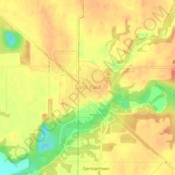
Name: St. Paul topographic map, elevation, terrain.
Location: St. Paul, Decatur County, Indiana, United States (39.42218 -85.63468 39.43342 -85.62235)
Average elevation: 258 m
Minimum elevation: 227 m
Maximum elevation: 272 m
Thank you for supporting this site ❤️
Make a donation
Make a donation
Other topographic maps
Click on a map to view its topography, its elevation and its terrain.