
Thank you for supporting this site ❤️
Make a donation
Make a donation
Tremelo topographic map
Click on the map to display elevation.
Thank you for supporting this site ❤️
Make a donation
Make a donation
About this map
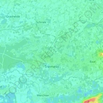
Name: Tremelo topographic map, elevation, terrain.
Location: Tremelo, Leuven, Flemish Brabant, Flanders, Belgium (50.97917 4.65286 51.02684 4.77431)
Average elevation: 11 m
Minimum elevation: 3 m
Maximum elevation: 56 m
Thank you for supporting this site ❤️
Make a donation
Make a donation
Other topographic maps
Click on a map to view its topography, its elevation and its terrain.