
Thank you for supporting this site ❤️
Make a donation
Make a donation
Lathrop topographic map
Click on the map to display elevation.
Thank you for supporting this site ❤️
Make a donation
Make a donation
Lathrop
Lathrop is located at 37°49′1″N 121°17′19″W / 37.81694°N 121.28861°W / 37.81694; -121.28861 (37.816904, -121.288633). The San Joaquin River cuts through the middle of Lathrop, the Old River (California) on the west side, and has elevation of 20 feet (7 m).
Thank you for supporting this site ❤️
Make a donation
Make a donation
About this map
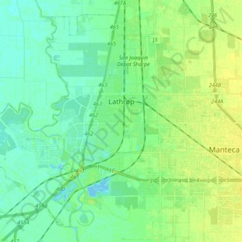
Name: Lathrop topographic map, elevation, terrain.
Location: Lathrop, San Joaquin County, California, United States (37.75979 -121.41428 37.86601 -121.26161)
Average elevation: 7 m
Minimum elevation: -4 m
Maximum elevation: 15 m
Thank you for supporting this site ❤️
Make a donation
Make a donation
Other topographic maps
Click on a map to view its topography, its elevation and its terrain.