
Thank you for supporting this site ❤️
Make a donation
Make a donation
Stockholm topographic map
Click on the map to display elevation.
Thank you for supporting this site ❤️
Make a donation
Make a donation
About this map
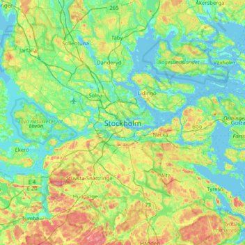
Name: Stockholm topographic map, elevation, terrain.
Location: Stockholm, Stockholms kommun, Stockholm County, 111 29, Sweden (59.16512 17.91109 59.48512 18.23109)
Average elevation: 26 m
Minimum elevation: -4 m
Maximum elevation: 97 m
Thank you for supporting this site ❤️
Make a donation
Make a donation