
Thank you for supporting this site ❤️
Make a donation
Make a donation
Liberty Island topographic map
Click on the map to display elevation.
Thank you for supporting this site ❤️
Make a donation
Make a donation
About this map
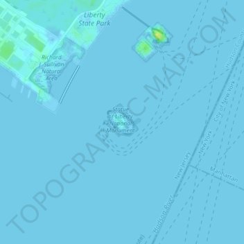
Name: Liberty Island topographic map, elevation, terrain.
Average elevation: 0 m
Minimum elevation: -1 m
Maximum elevation: 17 m
Thank you for supporting this site ❤️
Make a donation
Make a donation
Other topographic maps
Click on a map to view its topography, its elevation and its terrain.
Morningside Park
United States > New York > New York County > New York
Dutch settlers occupied Manhattan in the early 17th century and called the area around Morningside Park Vredendal, meaning 'peaceful dale'. The lowlands to the east were called Flacken by the Dutch, and were later translated to "Flats" in English. The land to the east was not settled initially because of its…
Average elevation: 20 m
Thank you for supporting this site ❤️
Make a donation
Make a donation
Thank you for supporting this site ❤️
Make a donation
Make a donation
Hunter’s Point South Waterfront Park
United States > New York > New York County > New York
Average elevation: 5 m