Trappe topographic map
Interactive map
Click on the map to display elevation.
About this map
![Trappe topographic map, elevation, terrain](/pub/maps/relation/46dn/89tmt/thumbnail.jpg)
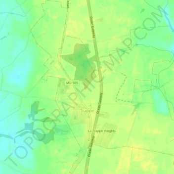
Name: Trappe topographic map, elevation, terrain.
Location: Trappe, Talbot County, Maryland, 21673, United States (38.64540 -76.07295 38.68114 -76.03231)
Average elevation: 13 m
Minimum elevation: 1 m
Maximum elevation: 21 m
Other topographic maps
Click on a map to view its topography, its elevation and its terrain.
![Wye Oak State Park topographic map, elevation, terrain](/pub/maps/way/w5k/9f3qvdn/icon.jpg)
Wye Oak State Park
United States > Maryland > Talbot County
Wye Oak State Park, Talbot County, Maryland, United States
Average elevation: 14 m
![Tilghman Island topographic map, elevation, terrain](/pub/maps/relation/xc9m/z5zfgp/icon.jpg)
Tilghman Island
United States > Maryland > Talbot County > Tilghman Island
Tilghman Island, Talbot County, Maryland, United States
Average elevation: 0 m
![Golton topographic map, elevation, terrain](/pub/maps/node/pf51/zsq8hnx/icon.jpg)
Golton
United States > Maryland > Talbot County > Easton
Golton, Easton, Talbot County, Maryland, 21601, United States
Average elevation: 16 m
![Tilghman Island topographic map, elevation, terrain](/pub/maps/node/9kf3/xnm3s3l/icon.jpg)
Tilghman Island
United States > Maryland > Talbot County
Tilghman Island, Talbot County, Maryland, 21671, United States
Average elevation: 1 m
![McDaniel topographic map, elevation, terrain](/pub/maps/node/m7m2/xntf1kl/icon.jpg)
McDaniel
United States > Maryland > Talbot County
McDaniel, Talbot County, Maryland, 21624, United States
Average elevation: 2 m
![Carters Plains topographic map, elevation, terrain](/pub/maps/node/m4rr/4x527m2/icon.jpg)
Carters Plains
United States > Maryland > Talbot County > Easton
Carters Plains, Easton, Talbot County, Maryland, 21601, United States
Average elevation: 15 m
![Oxford topographic map, elevation, terrain](/pub/maps/relation/fg18/13q3q/icon.jpg)
Oxford
United States > Maryland > Talbot County
Oxford, Talbot County, Maryland, United States
Average elevation: 1 m
![St. Michaels topographic map, elevation, terrain](/pub/maps/relation/xct6/mkndn/icon.jpg)
St. Michaels
United States > Maryland > Talbot County
St. Michaels, Talbot County, Maryland, 21663, United States
Average elevation: 2 m
![Bozman topographic map, elevation, terrain](/pub/maps/node/s9nh/xnps33l/icon.jpg)
Bozman
United States > Maryland > Talbot County > Bozman
Bozman, Talbot County, Maryland, 21612, United States
Average elevation: 2 m
![Canterbury topographic map, elevation, terrain](/pub/maps/node/1gnx/7181t18/icon.jpg)
Canterbury
United States > Maryland > Talbot County > Canterbury
Canterbury, Talbot County, Maryland, United States
Average elevation: 4 m
![Easton topographic map, elevation, terrain](/pub/maps/relation/pf51/7qszs/icon.jpg)
Easton
United States > Maryland > Talbot County
Easton, Talbot County, Maryland, 21601, United States
Average elevation: 10 m