
Thank you for supporting this site ❤️
Make a donation
Make a donation
Bierge topographic map
Click on the map to display elevation.
Thank you for supporting this site ❤️
Make a donation
Make a donation
About this map
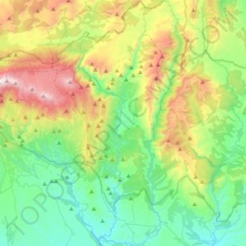
Name: Bierge topographic map, elevation, terrain.
Location: Bierge, Somontano de Barbastro, Huesca, Aragón, 22144, España (42.14499 -0.16363 42.36058 -0.02999)
Average elevation: 935 m
Minimum elevation: 443 m
Maximum elevation: 2,034 m
Thank you for supporting this site ❤️
Make a donation
Make a donation
Other topographic maps
Click on a map to view its topography, its elevation and its terrain.
Embalse de El Grado
España > Aragón > Somontano de Barbastro > Sobrarbe > El Grado
Average elevation: 673 m
Thank you for supporting this site ❤️
Make a donation
Make a donation
Castejón del Puente
España > Aragón > Somontano de Barbastro > Castejón del Puente > Castejón del Puente
Average elevation: 317 m