
Thank you for supporting this site ❤️
Make a donation
Make a donation
Highland County topographic map
Click on the map to display elevation.
Thank you for supporting this site ❤️
Make a donation
Make a donation
Highland County
Highland County is a county located in the U.S. state of Ohio. As of the 2020 census, the population was 43,317. Its county seat is Hillsboro. The county is named for the topography which is hilly and divides the watersheds of the Little Miami and Scioto Rivers.
Thank you for supporting this site ❤️
Make a donation
Make a donation
About this map
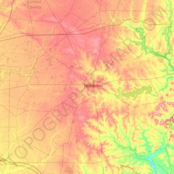
Name: Highland County topographic map, elevation, terrain.
Location: Highland County, Ohio, United States (39.01846 -83.87217 39.37876 -83.34396)
Average elevation: 305 m
Minimum elevation: 203 m
Maximum elevation: 401 m
Thank you for supporting this site ❤️
Make a donation
Make a donation
Other topographic maps
Click on a map to view its topography, its elevation and its terrain.