
Thank you for supporting this site ❤️
Make a donation
Make a donation
Dierks topographic map
Click on the map to display elevation.
Thank you for supporting this site ❤️
Make a donation
Make a donation
About this map
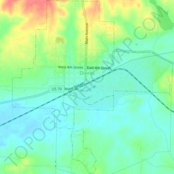
Name: Dierks topographic map, elevation, terrain.
Location: Dierks, Howard County, Arkansas, United States (34.10062 -94.03327 34.13271 -93.99754)
Average elevation: 139 m
Minimum elevation: 119 m
Maximum elevation: 179 m
Thank you for supporting this site ❤️
Make a donation
Make a donation
Other topographic maps
Click on a map to view its topography, its elevation and its terrain.