
崇明岛 topographic map
Interactive map
Click on the map to display elevation.
About this map
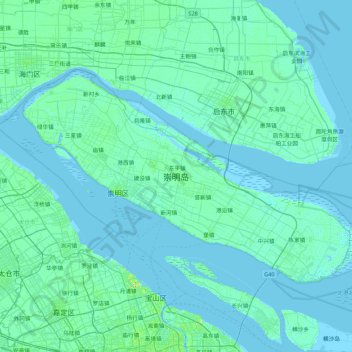
Name: 崇明岛 topographic map, elevation, terrain.
Location: 崇明岛, 天真区, 崇明区, 上海市, 202150, 中国 (31.43733 121.16047 31.88011 122.01788)
Average elevation: 3 m
Minimum elevation: -3 m
Maximum elevation: 33 m
Other topographic maps
Click on a map to view its topography, its elevation and its terrain.